
From the national records
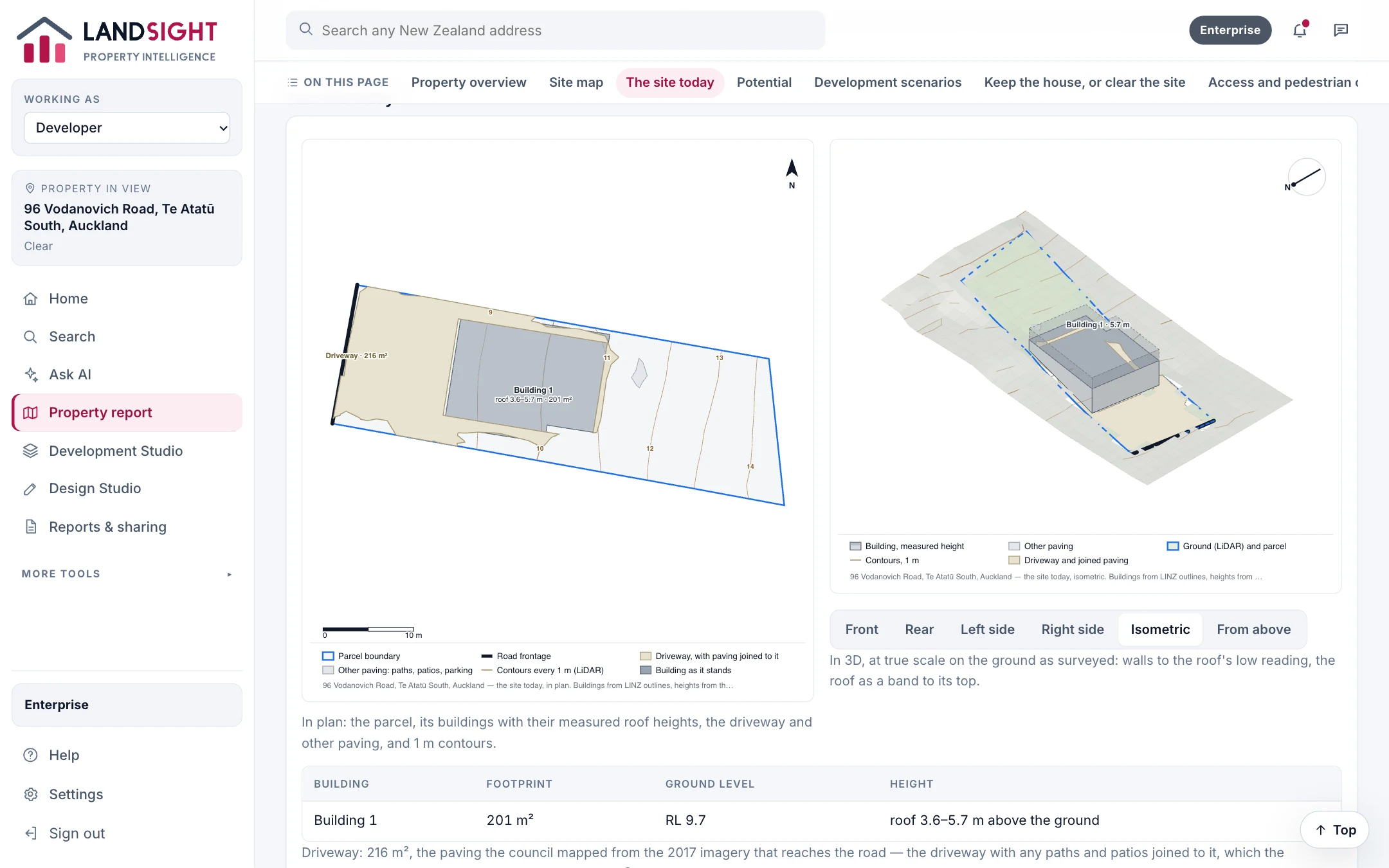
The surveyed parcel and building outlines from LINZ, and the ground from the LINZ 1 m LiDAR elevation model, for contours, levels and building heights.
Maps and site analysis
Landsight draws the site as it is — its boundary, buildings, driveway and ground — with the zone, the building envelope, contours, flood areas and service networks around it.
The surveyed parcel and building outlines from LINZ, and the ground from the LINZ 1 m LiDAR elevation model, for contours, levels and building heights.
Addresses, titles, parcels and building outlines cover all of New Zealand from LINZ. Council zoning, hazard and service layers are included where Landsight has integrated the council — Auckland today — and elsewhere the report says what it could not check.
Plans with contours and levels, and 3D views of the site and what could be built on it, from preset angles.
Which plan has it
Starter sees the site in its property report. Premium adds the full site analysis and the building envelope.
Related
Start free — no credit card. Two property reports a day, and every source named.