
For developers, architects and builders

From a site to a feasible scheme

Landsight reads a site's zone, boundary, levels and services, lays out what fits — a house, a duplex, townhouses along the street — and costs each option, so you know what a site can take before you pay for drawings.

  • No credit card required
Download a sample report96 Vodanovich Road, Te Atatū South · PDF, 2 MB
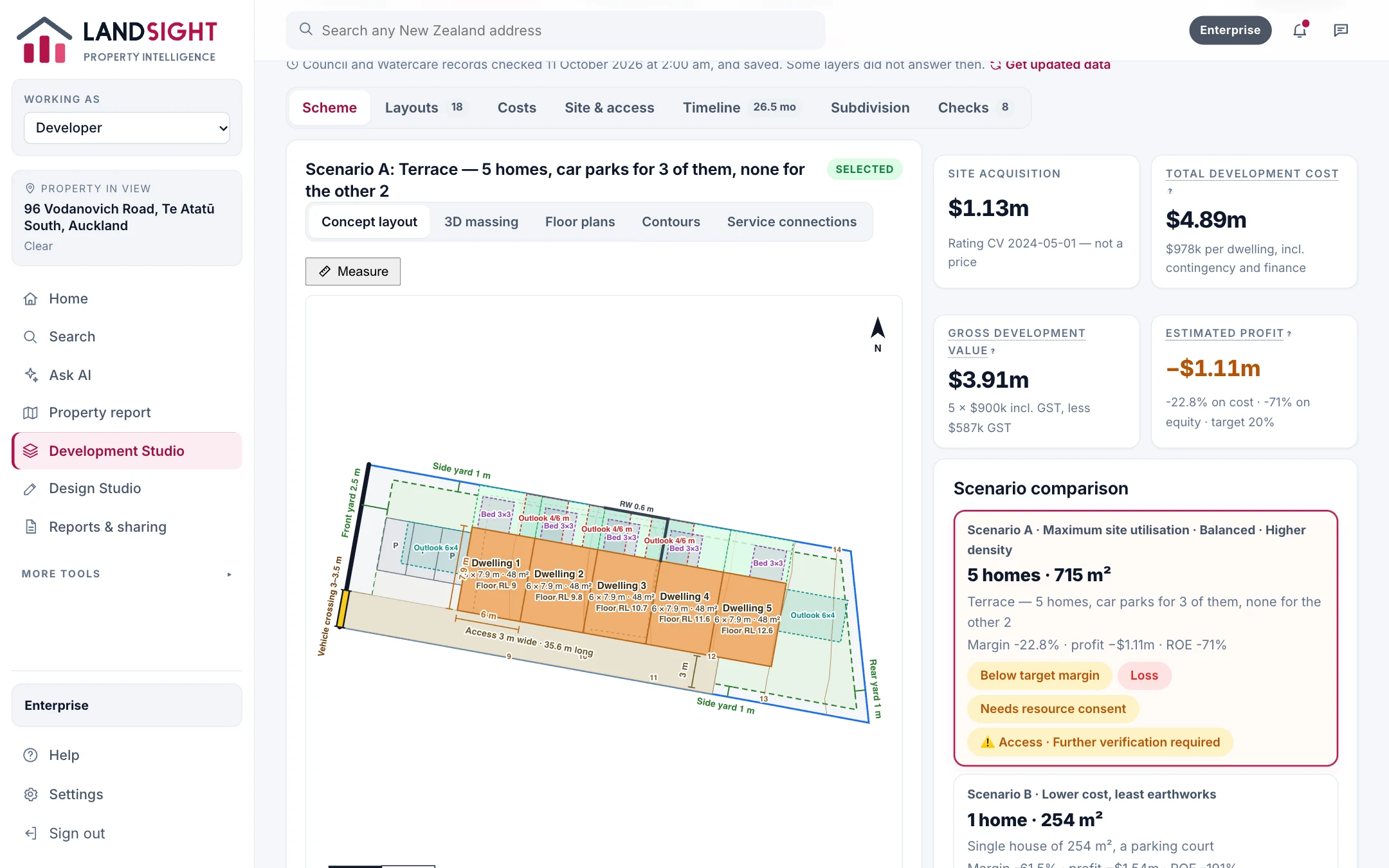
Development options laid out and costed for a site: 96 Vodanovich Road, Te Atatū South
Landsight on a real address: 96 Vodanovich Road, Te Atatū South

The site, measured

The surveyed boundary, the buildings on it with heights measured from LiDAR, contours, the zone's controls and the building envelope, with flood and service constraints where the council's layers are integrated.

  • Zoning and planning controls, with the envelope drawn
  • Contours and levels from the LINZ 1 m elevation model
  • Stormwater and wastewater networks near the site (Auckland)

Layouts for the whole site

Single homes fitted to the site, street-facing homes with garages, side-by-side and stacked duplexes, and townhouses — each with its parking, outdoor space and the retaining the ground needs.

  • Maximum, lowest-cost, balanced and highest-density options
  • What limits each option from holding one more home
  • Split levels and retaining on sloping sites

Costed, and drawn

Each option is costed at market rates for a standard specification, with margin and profit. Take one into the Design Studio to design the homes in plan and in 3D.

Which plan has it

Starter shows the site in its property report. Feasibility, layouts, costs and floor plans are in Premium.

Compare the plans

Related

Try it on your next property

Start free — no credit card. Two property reports a day, and every source named.