
Property intelligence

Property reports from the official record

One page on a property, built from the records: LINZ titles, parcels and building outlines, council valuations, zoning and hazards, and the ground from LiDAR. Shared by link or saved as a PDF, exactly as it was made.

  • No credit card required
Download a sample report96 Vodanovich Road, Te Atatū South · PDF, 2 MB
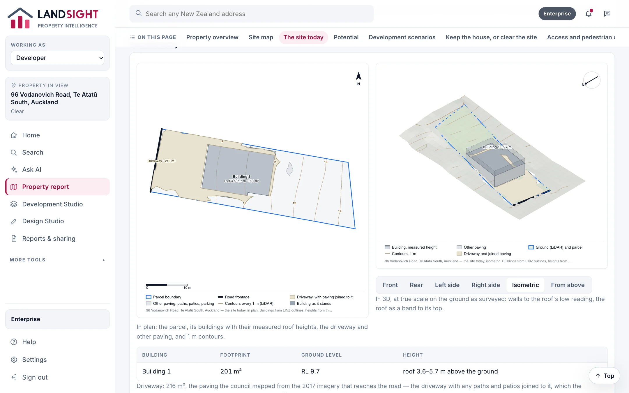
The site today in plan and in 3D: 96 Vodanovich Road, Te Atatū South
Landsight on a real address: 96 Vodanovich Road, Te Atatū South

What a report contains

Every section names its source, and anything Landsight could not check is listed rather than filled in.

  • The property and its title and legal records
  • Land and parcel, buildings and improvements, contours
  • The site today: buildings, driveway and paving in 2D and 3D
  • Zoning, services and flooding on one map
  • Potential: a granny flat, subdivision, or clearing and rebuilding (Premium)
  • Development scenarios, costed (Premium)

Coverage

Addresses, titles, parcels and building outlines cover all of New Zealand from LINZ. Council zoning, hazard and service layers are included where Landsight has integrated the council — Auckland today — and elsewhere the report says what it could not check.

Sharing

Send a report by link, email or WhatsApp. The link shows that report only, lasts 7, 30 or 90 days, and can be withdrawn at any time. The PDF is the same report.

Which plan has it

Starter: two reports a day. Premium: no daily limit, with potential and scenarios. Enterprise: shared across a team.

Compare the plans

Related

Try it on your next property

Start free — no credit card. Two property reports a day, and every source named.